The Urban Mosquito Problem and Mosquito Borne Diseases
The low, familiar buzz of a mosquito is more than just an annoyance on a warm summer evening—it’s a harbinger of a public health risk. In the vast, sun-drenched landscape of Los Angeles, this risk is magnified by the sheer scale of the city and its countless potential breeding grounds. These breeding areas include a wide range of mosquito habitats, from natural marshes to artificial swimming pools, each serving as a breeding habitat that supports mosquito reproduction and population growth. These overlooked sites can quickly become vibrant nurseries for disease-carrying mosquitoes, exacerbating the rates of West Nile virus and dengue fever currently spreading through Los Angeles.
Effective mosquito control is essential for protecting human health and plays a critical role in disease control by preventing the spread of mosquito-borne illnesses. Due to the sheer scale of the city, the rapid reproduction of mosquitoes, and the multitude of potential mosquito breeding grounds, this is a herculean task. But what if we could change the game? What if we could see the problem from a new perspective and act with unprecedented speed? This isn’t about aerial spraying; it’s about a new kind of reconnaissance, a solution that takes flight to safeguard public health on the ground.
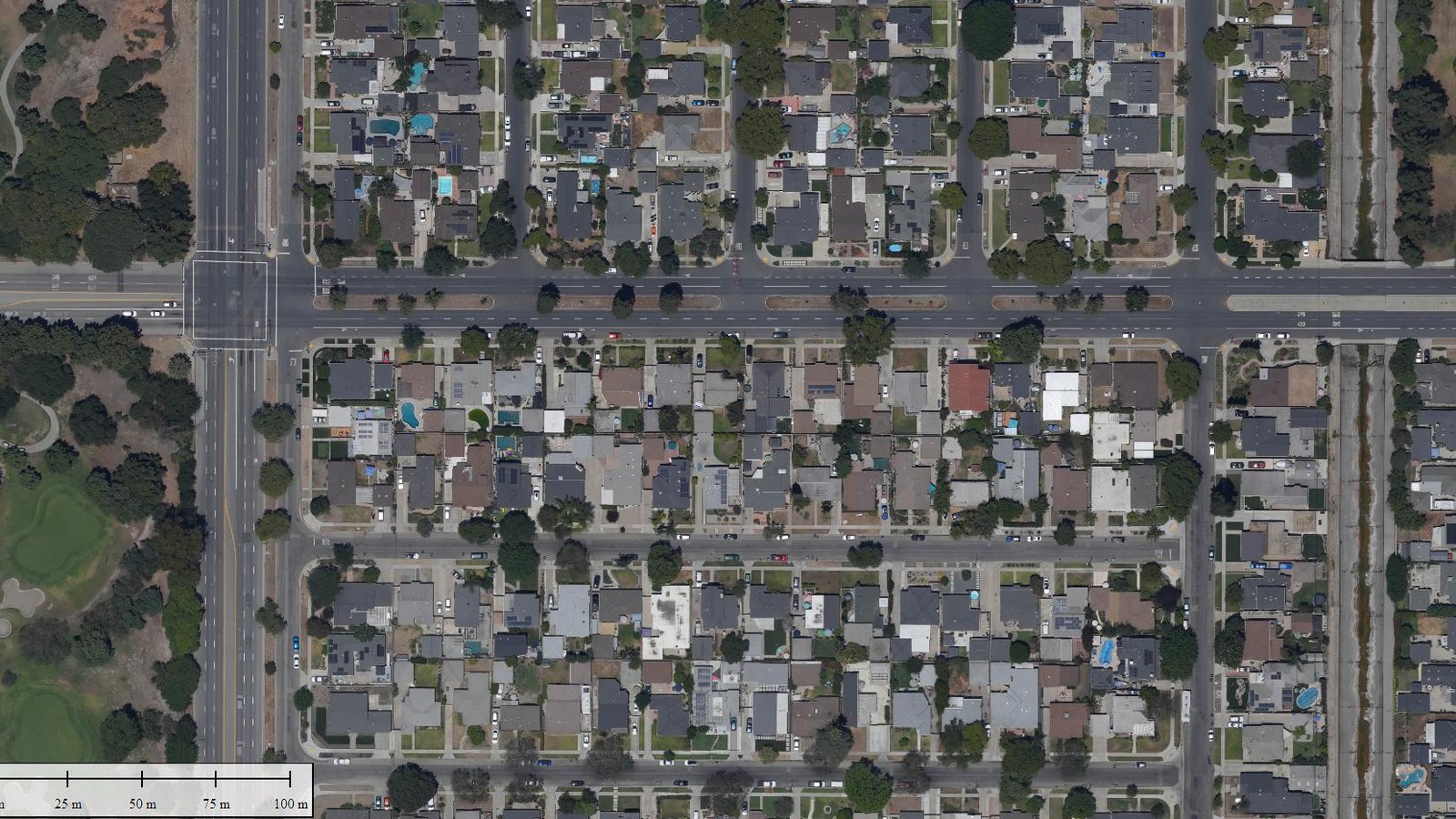
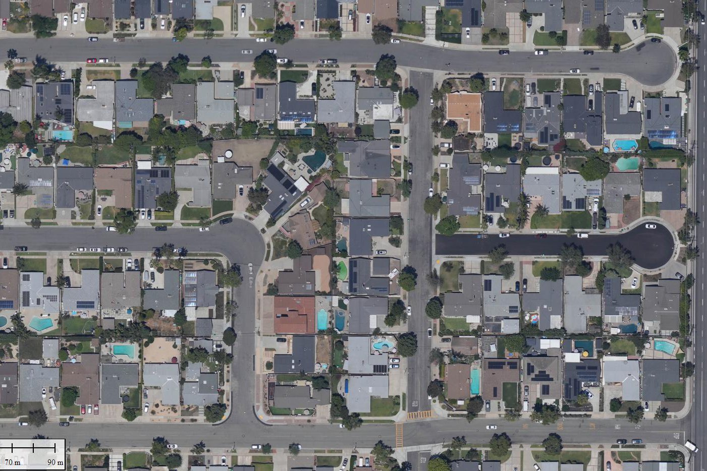
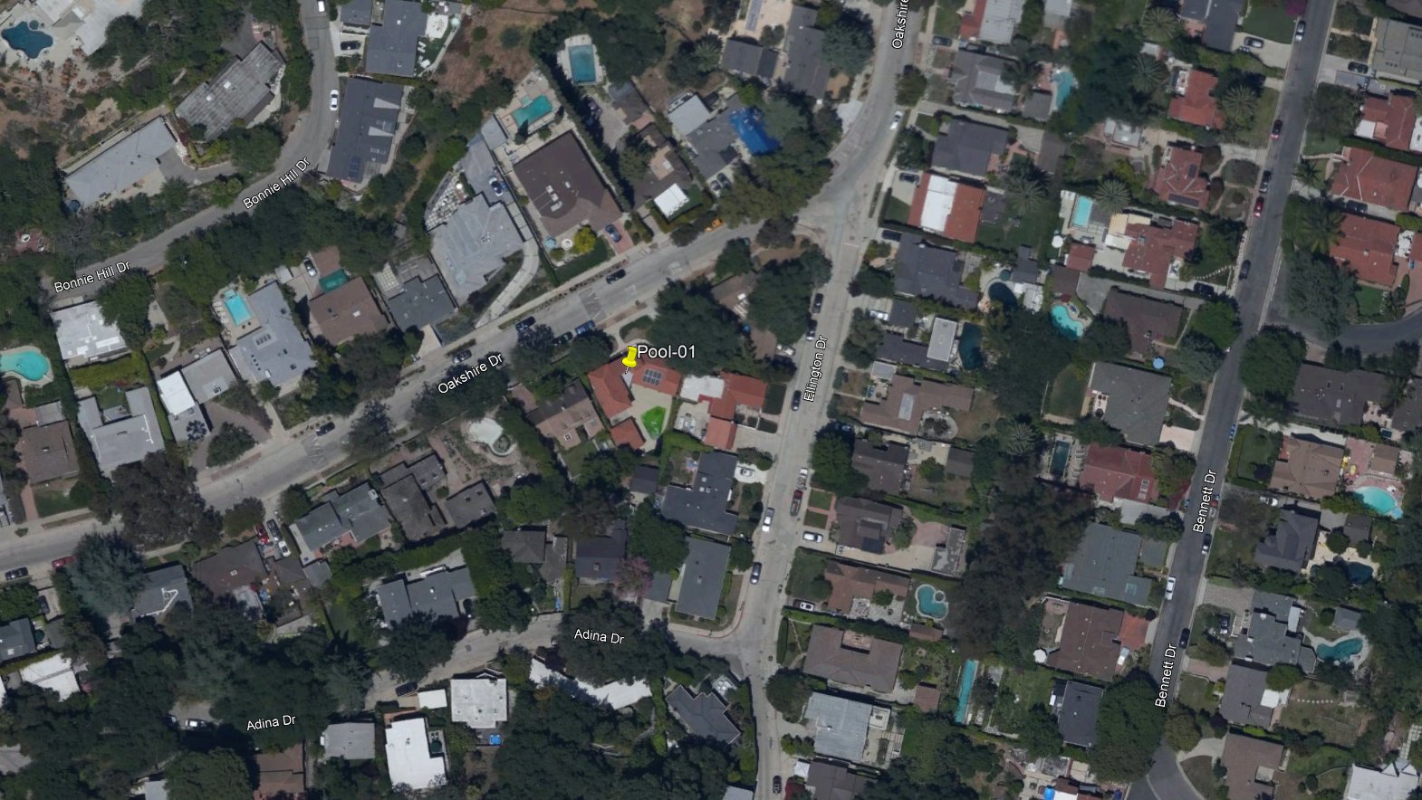
Advancements in digital photography and mapping techniques allows for the quick capture and generation of aerial maps, where green and blue swimming pools can be easily detected (left of image center, near the intersection)
The Old Way vs. The New Way of Managing Mosquitoes
For decades, the battle against mosquitoes has been a reactive one. Vector control districts have relied on dedicated ground teams to respond to public complaints, a method that is both labor-intensive and inherently slow. Field technicians do their best, but covering a massive city on a block-by-block basis is an immense, if not impossible, task. The traditional approach is like searching for a needle in a haystack, one straw at a time. When there are many mosquitoes and widespread breeding sites, rapid source reduction—eliminating standing water and other breeding habitats—becomes a key challenge that is difficult to address with limited resources.
This is where aerial mapping can offer a significant leap forward. A single airplane, equipped with specialized cameras, can capture high-resolution imagery of a vector control area in a matter of hours—an area that would take ground crews weeks or even months to cover. This imagery is able to provide a comprehensive, bird’s-eye view, revealing hidden breeding sites, such as neglected green swimming pools, that are invisible from the street. This proactive “seek and treat” strategy would allow vector control teams to move from responding to the problem to getting ahead of it, transforming their operations from defensive to offensive. By enabling the adoption of new control strategies, such as targeted habitat modification and integrated management, aerial mapping is able to improve both the efficiency and effectiveness of mosquito control efforts.
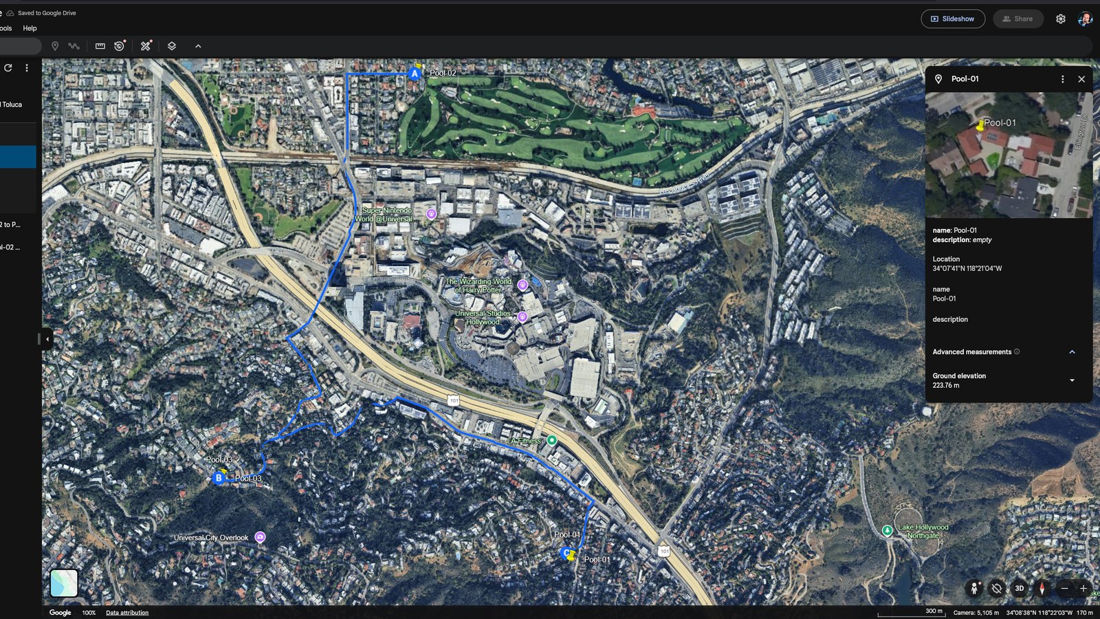
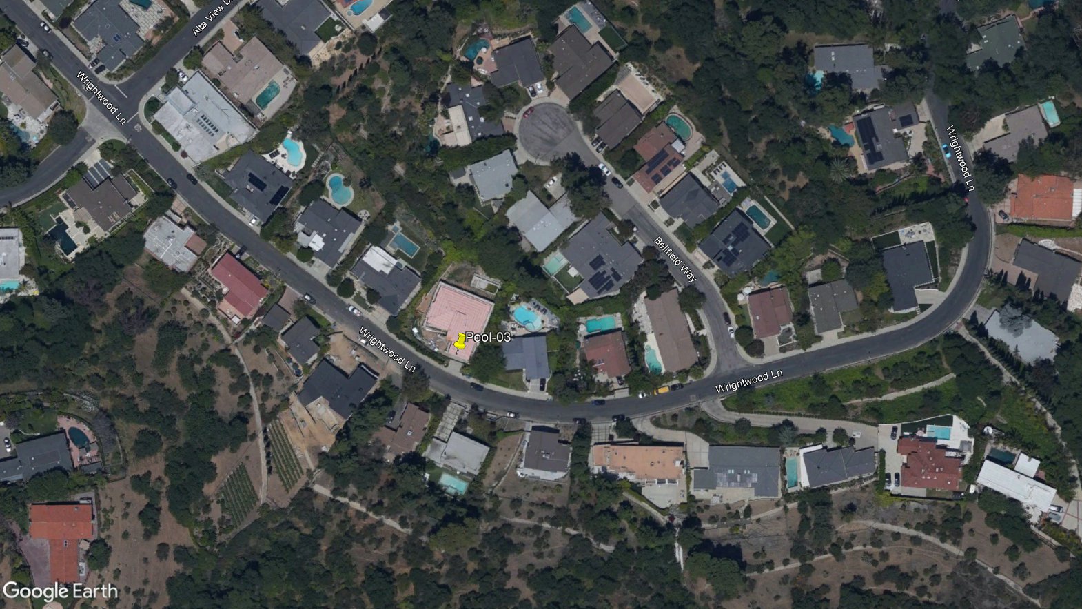
Online tools such as Google Earth allow collaboration on data sets, with staff in the office able to plan and assist teams working out in the field to identify and mitigate mosquito larvae populations.
The Process: From Sky to Street—Targeting Mosquito Larvae
The process begins with meticulous coordination between the aerial mapping specialists and the local vector control district. A flight plan needs to be carefully crafted to cover an area small enough for the ground crews to manage within a single one-week period, ensuring the data is both fresh and actionable.
The airplane then takes to the sky, acquiring high-resolution imagery of the designated area. The advanced sensors and cameras used in this process detect the visual signatures of stagnant, algae-filled pools, painting a clear picture of potential breeding sites.
The true revolution, however, lies in the rapid delivery of this intelligence. The captured imagery is processed within a 24-hour window, a critical timeframe when you consider the life cycle of a mosquito. In warm conditions, a mosquito can go from a newly laid egg to a biting adult in as little as 5 to 7 days. Since mosquito eggs quickly hatch into larvae, intervening during the larval stage is essential to prevent the development of adult mosquito populations. This rapid processing ensures that the vector control team receives actionable intelligence before the next generation of mosquitoes has a chance to emerge.
The final product is a digital “hit list” delivered electronically as a web-based Google Earth KML file. This online data set contains the high-resolution imagery as a ground overlay, with pinpoint placemarks on every identified green swimming pool. Each pinpoint includes the street address and precise latitude/longitude coordinates. These digital pins can be easily imported into Google Maps and shared with teams, creating a turn-by-turn navigation route for ground crews to follow. This allows them to move efficiently from site to site without wasting time searching or plotting their own paths, maximizing their time and impact on the ground. These mosquito control activities can help monitor and manage mosquito populations before they become a public health threat.
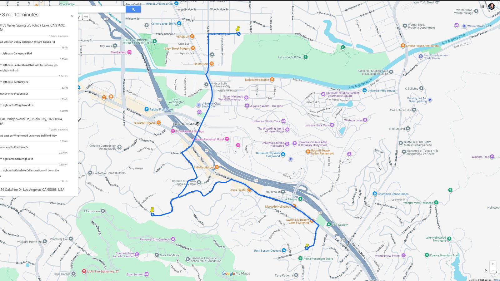
Step-by-step driving directions from each detected green pool can be passed to remote mosquito control teams to address quickly and efficiently.
The Impact and Future of Efforts to Control Mosquitoes
This technological innovation can fundamentally change the landscape of public health in Los Angeles. It offers the ability save invaluable time and resources, allowing vector control crews to focus on what they do best: treating the problem, not just finding it. This increased efficiency translates directly into improved public health outcomes, as the risk of vector-borne diseases is dramatically reduced.
But the potential extends beyond just green swimming pools. The same data sets can be used to identify other types of stagnant water sources, from construction sites to hidden drainage areas. This is particularly valuable in emergency response situations following natural disasters, when rapid intervention is needed to kill mosquito larvae before they can fully mature, preventing disease outbreaks. In a city as vast and complex as Los Angeles, this fusion of aviation and data is not just a new tool; it’s a new era of public health, making our communities safer and more secure for everyone.
Understanding Mosquito Populations
To truly control mosquitoes, it’s essential to understand the makeup and behavior of the mosquito populations in Southern California. These populations are made up of both adult mosquitoes—the ones responsible for those itchy mosquito bites and the spread of mosquito borne diseases—and mosquito larvae, which develop in standing water before emerging as adults. Effective mosquito control hinges on targeting both stages: larval mosquitoes are tackled before they can mature, while adult mosquitoes need to be managed to reduce biting and disease transmission.
Mosquito control districts rely on a combination of mosquito surveillance, larval control, and targeted treatments to keep mosquito populations in check. By monitoring where mosquitoes breed and how their numbers fluctuate, control efforts can be focused where they’re needed most. This means identifying standing water, understanding the breeding habits of different mosquito species, and acting quickly to disrupt the mosquito life cycle. By addressing both adult and larval mosquitoes, these programs help prevent outbreaks and protect public health, making our neighborhoods safer from nuisance mosquitoes and the diseases they can carry.
Aerial view of a green swimming pool in a backyard. Away from public view, these mosquito breeding grounds often go unseen and only get reported once the mosquito population is out of control.
Biological Control: Nature’s Own Mosquito Managers
Nature has its own solutions for keeping mosquito numbers in check. Biological control methods harness the power of natural enemies to reduce mosquito populations in a sustainable way. Dragonflies, birds, and bats all play a role in controlling adult mosquitoes, helping to keep populations in balance. By working with nature to foster populations of these voracious mosquito hunters, mosquito control programs can reduce reliance on chemical pesticides and create healthier, more resilient ecosystems—all while keeping mosquitoes at bay.
A neglected swimming pool behind a home under construction is partially filled with green-brown water, often creating perfect conditions for mosquito larvae.
How to Control Adult Mosquitoes: Beyond Chemicals and Sprays
While chemical sprays and mosquito traps can be effective, there are many alternative methods for controlling mosquitoes that are safe, practical, and environmentally friendly. Physical control methods, such as filling tree holes, cleaning rain gutters, and removing standing water from wading pools and bird baths, are some of the most effective ways to prevent mosquito breeding. Biological solutions, like mosquito dunks and mosquito bits—products containing natural bacteria that kill mosquito larvae—can also be added to water features to control mosquito larvae without harming other wildlife. Eliminating these breeding habitats stops mosquitoes before they can even get started. To protect against adult mosquitos, installing window & door screens and wearing permethrin treated clothing are all proven ways to keep existing mosquitoes at bay and, more importantly, prevent mosquito bites.
Working together, we can create a healthier, safer environment for everyone in Los Angeles and beyond.