Nestled along the beautiful California coastline, Port Hueneme is a gem of Ventura County, known for its charming marinas, exquisite residential areas, and the breathtaking Port Hueneme Lighthouse. Through aerial photography, we can capture the stunning beauty and unique aspects of this coastal city.
What is Aerial Photography?
Aerial photography is an art form that uses elevated vantage points, typically from an airplane, to capture unique perspectives of landscapes, cityscapes, and landmarks. This specialty type of photography is perfect for advertising, marketing, real estate listings, and much more. With aerial photography, the sky is literally the limit.
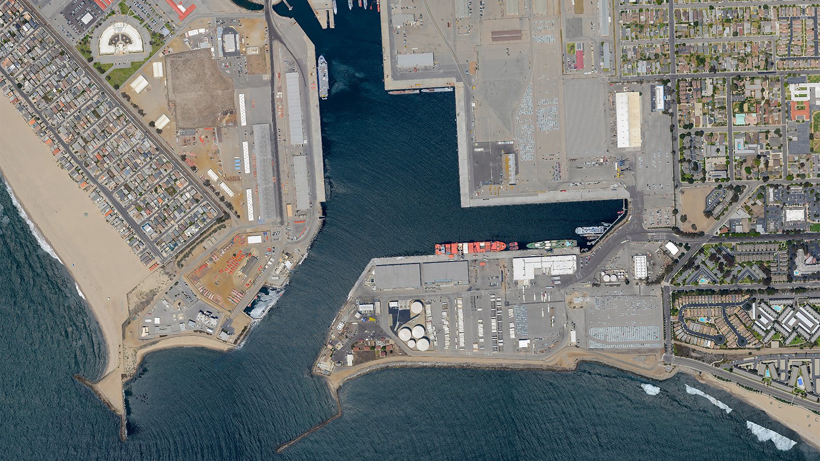
A close-up aerial view of a large EUKOR car transport ship docked and unloading its cargo at the Port of Hueneme.
The Benefits of Aerial Photography in Port Hueneme
Port Hueneme, with its peaceful beaches and scenic parks, like Moranda Park and the bustling Hueneme Beach Pier, offers a rich tapestry of visuals for aerial photography. Whether it's showcasing your seaside property or capturing the progress of a community project, aerial photography provides unmatched perspectives.
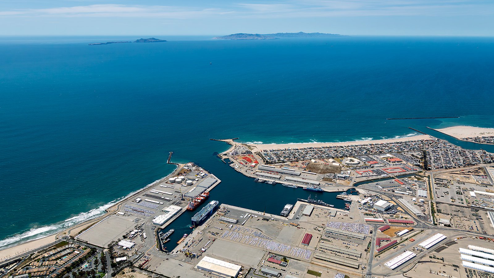
Aerial photograph of the Port of Hueneme and its adjacent coastline, extending out into the vast expanse of the Pacific Ocean. In the distance, the Channel Islands are visible, specifically Anacapa Island and Santa Cruz Island.
Marketing Real Estate
Real estate agents can benefit immensely from aerial photography, helping to showcase residential or commercial properties in and around Port Hueneme. Aerial photos give potential buyers a comprehensive view of the property and its surroundings, adding significant value to the marketing of expansive properties.
Dewar Park is reduced to dirt as it undergoes landscaping renovations, providing a glimpse into the urban development throughout Port Hueneme.
Monitoring Progress on Construction Projects
Aerial photography is also an effective tool for documenting progress on large-scale construction projects. Regular aerial photo sessions give a clear overview of the development without the need for constant on-site monitoring, saving time and resources. These photographs also serve as an accurate historical record, useful for insurance and legal purposes.
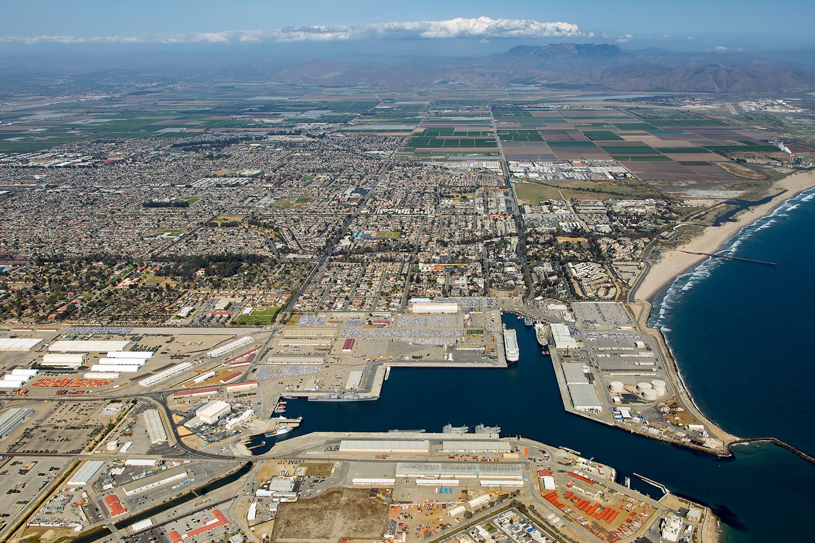
A detailed overhead view capturing the intricate layout of the Port of Hueneme, its bustling terminals, and adjacent coastline.
Mapping Entire Neighborhoods
With high-resolution cameras mounted on aircraft, aerial photography enables surveying large areas with unparalleled precision. These aerial maps are invaluable for various planning purposes and for businesses, like roofing contractors, who can identify potential leads, such as roofs in need of repair.
Whether you need a stunning aerial view of your property, want to document your construction project's progress, or desire captivating shots of the Port Hueneme cityscape, West Coast Aerial Photography, Inc. is your go-to aerial photography solution!
Get in Touch Today
From the tranquil beaches to the iconic Port Hueneme Lighthouse, our photographs aim to portray the unique essence of this charming coastal Southern California city.