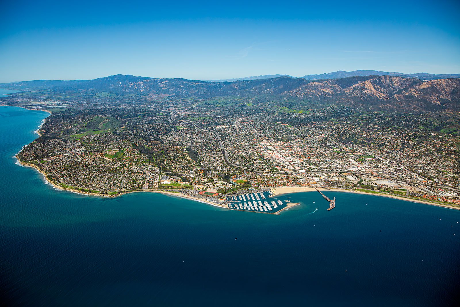
This picturesque city of Santa Barbara, cradled between the Pacific Ocean and the Santa Ynez Mountains, offers a diverse landscape waiting to be captured in stunning aerial detail. From the pristine coastline to the historic missions, aerial photography gives a new perspective to the unique charm of Santa Barbara.
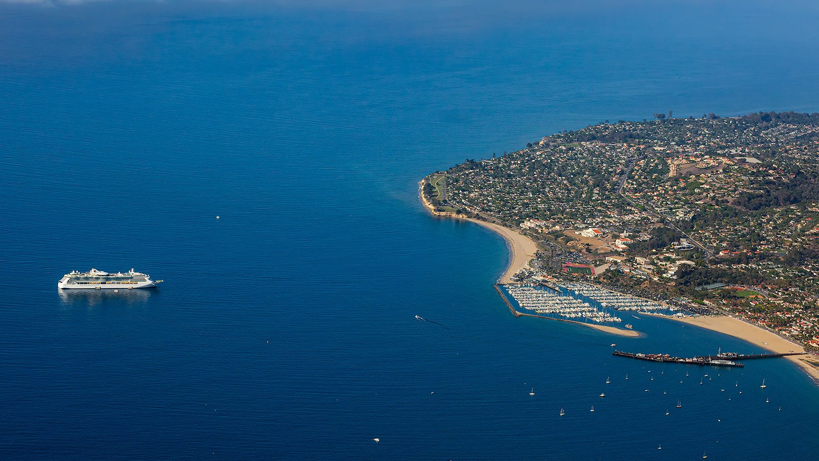
The Royal Caribbean's Jewel of the Seas, a luxurious 962-foot long cruise ship, sitting in the sparkling blue waters of the Pacific Ocean, off the coast of Santa Barbara, California
What is Aerial Photography?
Aerial photography is an art form that involves capturing images from an elevated perspective, typically from an aircraft. This type of photography allows for unique viewpoints that cannot be achieved with traditional ground-level photography. Aerial photographers utilize aircraft to capture unique images of landscapes, cities, landmarks, and more. These images, used in various sectors like advertising, marketing campaigns, real estate, and more, open up new creative horizons.
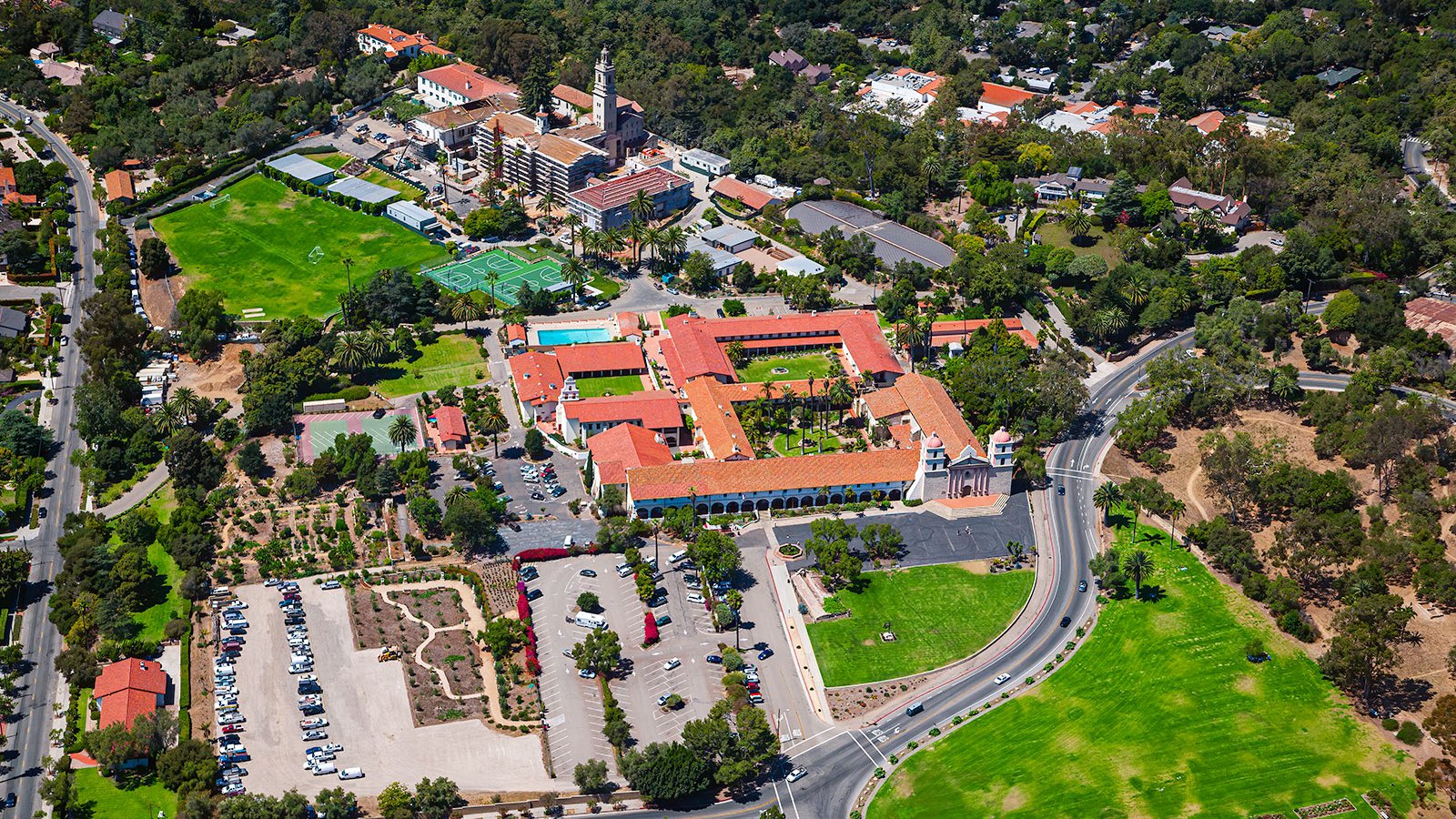
Aerial photograph of the iconic Old Mission Santa Barbara, founded by the Franciscan order in 1820, featuring a beautifully preserved Spanish colonial-style architecture and surrounding lush gardens.
The Benefits of Aerial Photography in Santa Barbara
Santa Barbara, often referred to as the "American Riviera," is home to an array of captivating landmarks from the iconic Stearns Wharf to the historic Santa Barbara Mission. The panoramic views of the city, coastline, and mountains make aerial photography an ideal choice, whether you're looking to market a property or document the progress of a construction project.
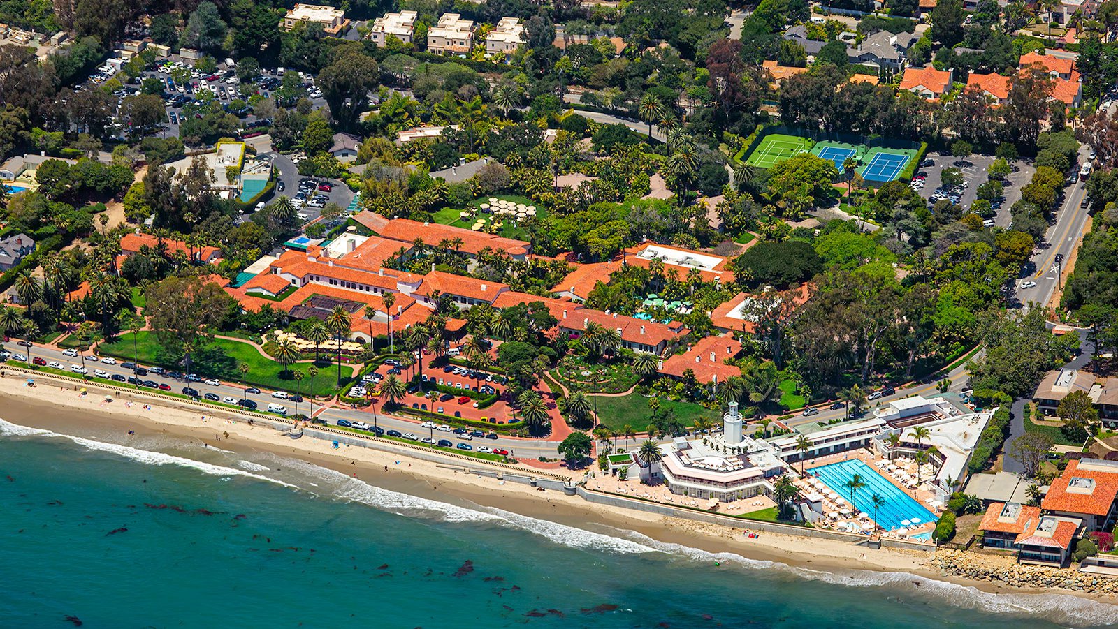
Aerial view of the Four Seasons Resort The Biltmore in Santa Barbara, California showing the luxurious Mediterranean-style architecture, botanical gardens, and a prime beachfront location.
Marketing Real Estate
Real estate agents can leverage aerial photography to effectively market residential or commercial properties listed for sale or rent in Santa Barbara. Aerial images give potential buyers and renters a comprehensive overview of the property and the surrounding neighborhood. This is particularly beneficial when marketing large estates or properties that are uniquely positioned, providing a perspective that ground photographs simply can't match.
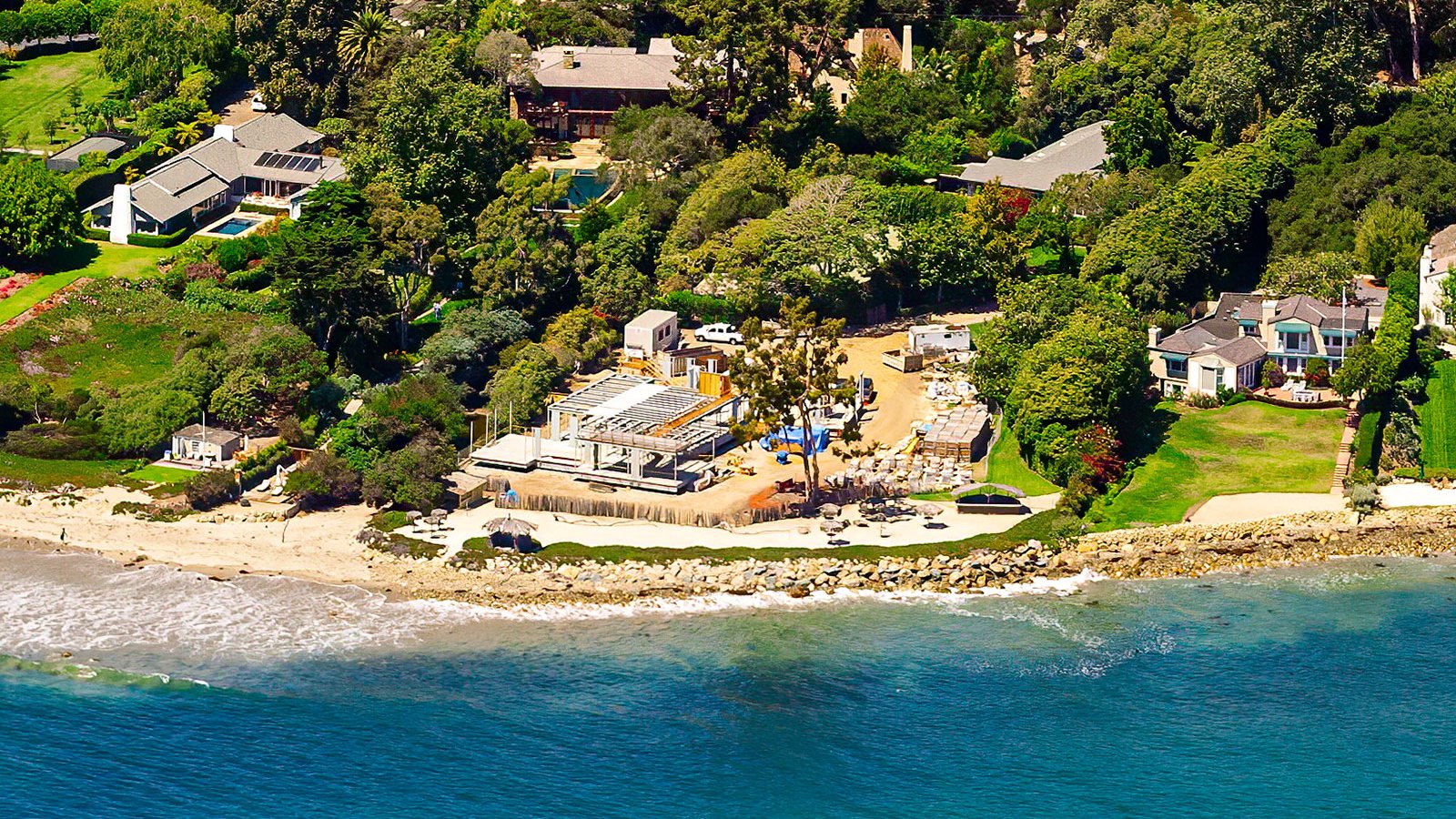
Aerial photo of ongoing construction of a luxurious beachfront home in Santa Barbara, featuring expansive outdoor living spaces and stunning ocean views.
Monitoring Progress on Construction Projects
Aerial photography proves invaluable in tracking the progress of sizeable construction projects. Regular aerial shoots can help contractors and developers to monitor the progress of their projects, from shopping centers to residential complexes, without the need for frequent on-site visits. This method is cost-effective, time-saving, and provides a detailed record of the project's development over time, which can also be useful for insurance purposes or legal disputes.
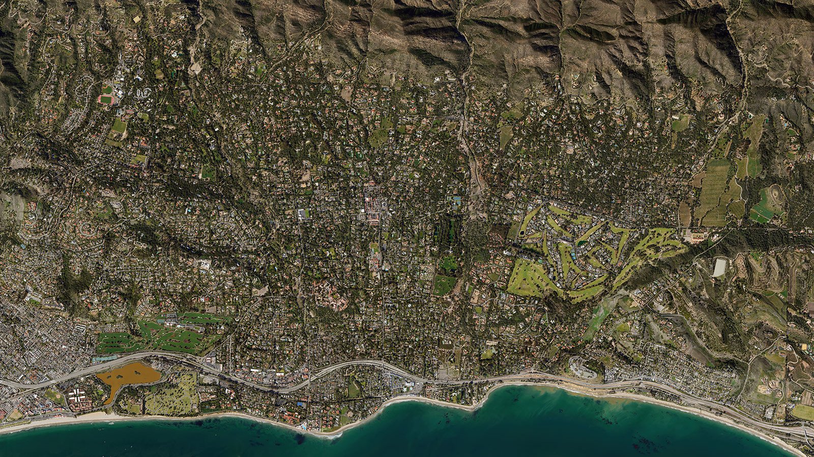
Detailed orthophoto of Montecito, California, captured in 2021, depicting the region's luxurious homes, expansive greenery, and winding roads, while also highlighting the areas affected by the devastating 2018 mudslides.
Mapping Entire Neighborhoods
With high-resolution cameras mounted on aircraft, aerial photography allows for the mapping of extensive areas, creating precise, high-resolution imagery for GIS and CAD applications. These aerial maps can be employed for urban planning or lead generation, such as identifying homes that require roofing repairs.
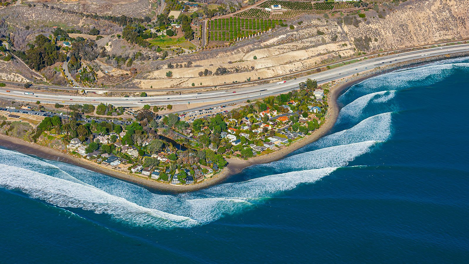
Aerial photo of homes lining the beachfront of Rincon Beach, a world-renowned surf spot located in southern California.
If you're in need of stunning aerial photography that captures the essence of Santa Barbara's beauty, or a practical solution to monitor large-scale projects, our aerial photography services offer the perfect solution. Here at West Coast Aerial Photography, we're committed to delivering top-tier aerial photography services in Santa Barbara.
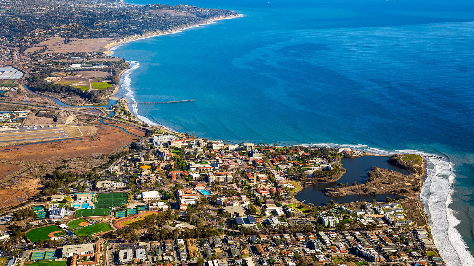
The beautiful and sprawling campus of UC Santa Barbara seen from the air, stretching out along the coastline and offering stunning views of the Pacific Ocean and nearby mountains, with downtown Santa Barbara visible in the distance.
Schedule a Photo Mission
From beautiful sunsets over the Santa Ynez mountains to aerial shots of vibrant downtown, we aim to encapsulate the unique allure of Santa Barbara in each photo we take.