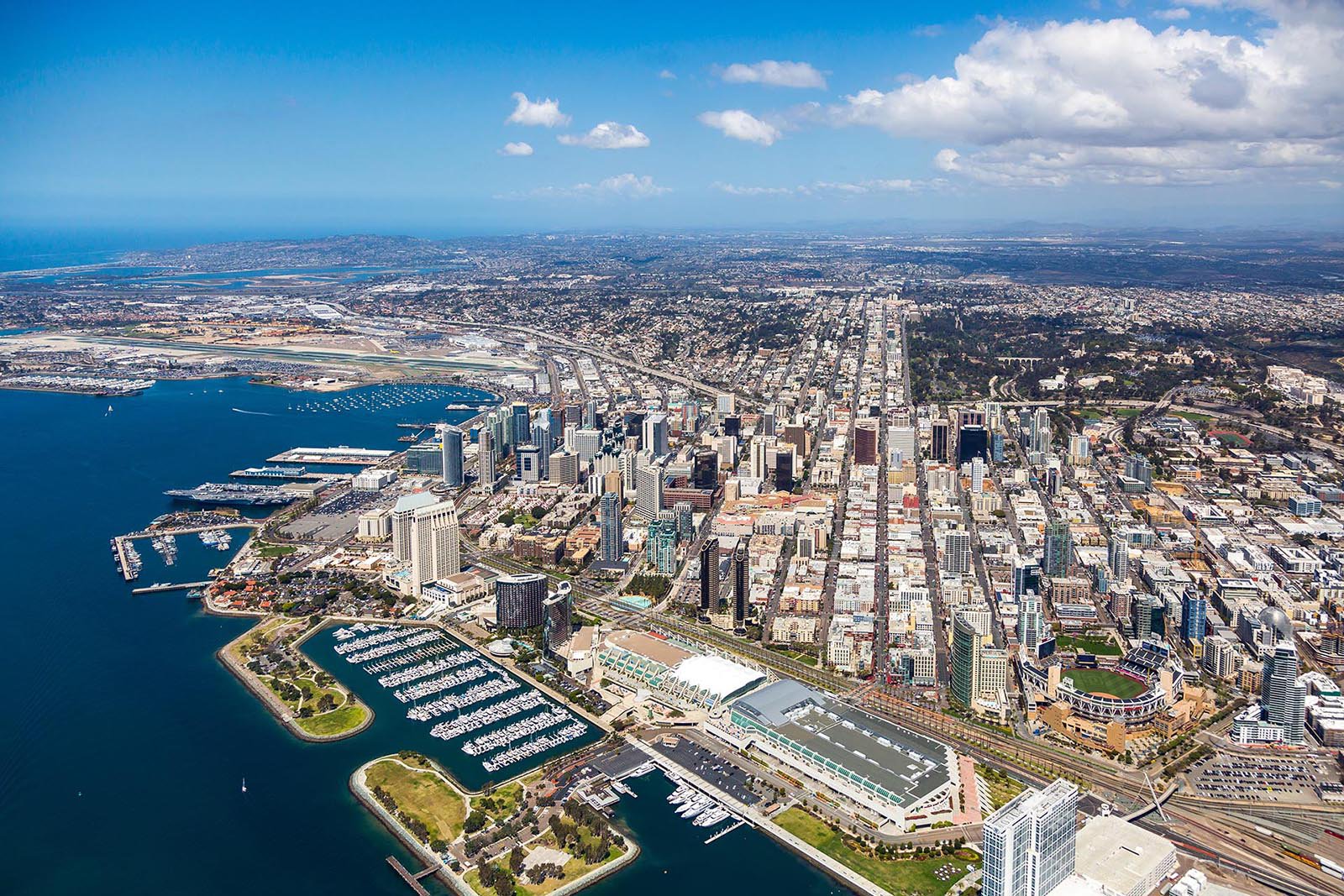
San Diego, California, known as "the birthplace of California," offers stunning opportunities for aerial photography with its breathtaking coastline, vibrant downtown, and diverse neighborhoods. From the picturesque La Jolla coves and historic Gaslamp Quarter to the expansive Balboa Park, our aerial photography services capture the unique beauty and character of San Diego and its surrounding areas.
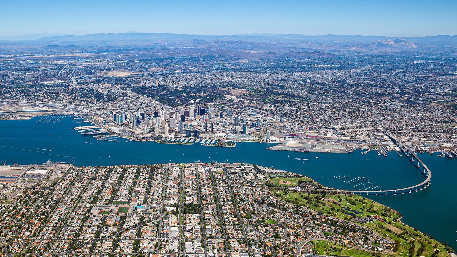
Aerial view of Downtown San Diego from the ocean, featuring Coronado Island in the foreground and the iconic Coronado Bridge gracefully connecting to the city on the right.
What is Aerial Photography?
Aerial photography is the art of capturing images from elevated positions, typically using a camera from an airplane. It provides unique and expansive perspectives that ground-based photography cannot achieve, revealing detailed views of landscapes, cityscapes, and structures from above. There are various types of aerial photography, including vertical shots taken directly overhead for mapping and surveying purposes, and oblique images captured at an angle to highlight architectural features or natural terrain. Aerial photography serves numerous applications, ranging from real estate marketing and construction project monitoring to environmental assessments and promotional campaigns. With its comprehensive visuals, aerial photography enhances storytelling, planning, and decision-making across a diverse range of industries.
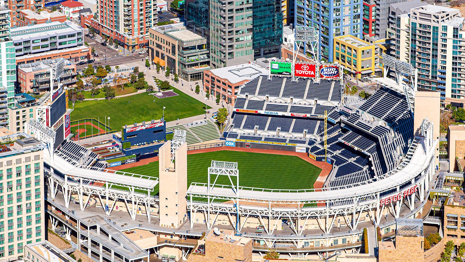
Bird's eye view of Petco Park baseball stadium, nestled among the high-rise buildings in Downtown San Diego, California.
The Benefits of Aerial Photography in San Diego
Aerial images showcase the vibrant urban skyline, coastal beauty, and sprawling neighborhoods of San Diego and its surrounding areas. With services tailored to meet various needs, including historical and current aerial maps, bespoke aerial photography services are an invaluable tool for professionals and businesses seeking to highlight properties, track development progress, or create impactful marketing content for projects across San Diego county.

Aerial view of coastal homes perched on cliffs along Camino de la Costa in La Jolla, California, showing the natural beauty of San Diego's Pacific shoreline.
Real Estate Marketing
Real estate marketing greatly benefits from aerial photography by capturing images and cinematic videos that showcase San Diego properties from unique perspectives. These aerial views highlight not only the property itself but also its surrounding neighborhoods and nearby amenities, providing potential buyers and renters with a comprehensive understanding of the location. This is especially beneficial for larger properties or commercial spaces where traditional ground-level photos may fail to capture the full scale and extent of the site. Incorporating aerial photography into real estate listings enhances visual appeal and helps properties stand out in a competitive market.
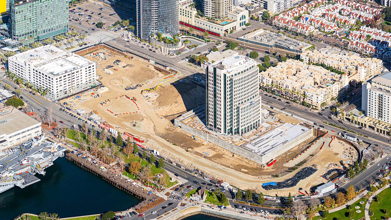
Aerial photo showing the construction progress of the Manchester Pacific Gateway project, an ambitious $1.5 billion, 8-acre development in Downtown San Diego featuring office spaces, luxury apartments, retail and hospitality venues, and a new public park set to reshape the city's skyline and economy.
Tracking Construction Project Progress
Aerial photography plays a crucial role in monitoring the progress of large-scale construction projects across San Diego, from commercial complexes to residential developments. Regular aerial photo sessions enable contractors and developers to efficiently track construction milestones without frequent on-site visits, saving both time and resources. These images provide a comprehensive overview of project development over time, supporting accurate documentation and facilitating informed decision-making. Additionally, aerial photographs serve as valuable evidence for insurance claims and legal disputes, ensuring accountability and transparency throughout the construction process.
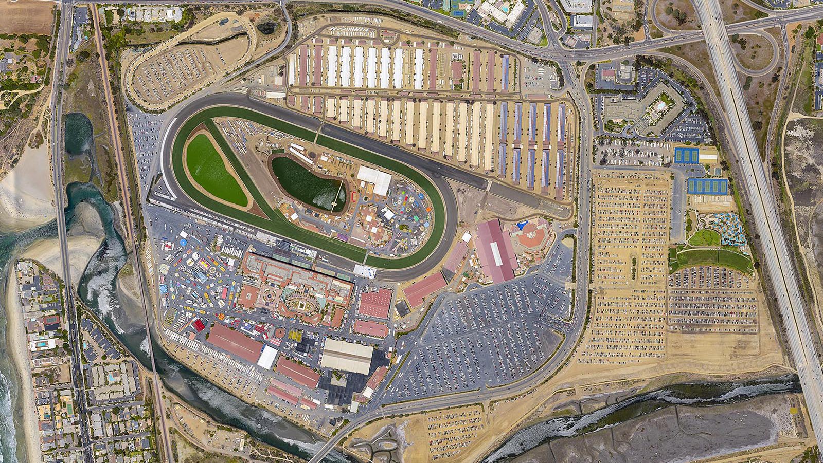
Orthophoto of the San Diego Fair at the Del Mar Fairgrounds in Del Mar, California, offering an accurate, orthographically corrected, bird's-eye view of the event's layout.
Mapping Entire Neighborhoods
Aerial mapping offers significant practical advantages by utilizing high-resolution cameras mounted on aircraft to efficiently survey large areas. This process generates precise and detailed imagery essential for Geographic Information Systems (GIS) and Computer-Aided Design (CAD) applications. Key products of aerial mapping include orthophotos, which are geometrically-corrected aerial photographs, and digital elevation models (DEMs), a three dimensional representation of the earth's surface. These tools support various uses such as construction monitoring, project planning, topographic mapping, and LiDAR data integration. For contractors and planners, aerial mapping facilitates identifying structural needs like roof repairs and enhances decision-making through comprehensive and actionable spatial data.

Close-up aerial view of visitors exploring various aircraft on the deck of the USS Midway aircraft carrier museum in San Diego, featuring iconic planes such as the F-14 Tomcat, A-4 Skyhawk, and F/A-18 Hornet.
Whether you need to track the progress of a construction project or want stunning aerial images that showcase the unique beauty of the San Diego cityscape, aerial photography is the perfect solution. For top-quality San Diego aerial photography services, trust the expertise and professionalism of Mark and Steven at West Coast Aerial Photography, Inc. to deliver high-resolution images that truly capture the essence of this vibrant city.
Schedule a Photo Mission
From capturing the dynamic energy of downtown San Diego to the serene beauty of sunsets at La Jolla Cove, our San Diego aerial photography services are designed to showcase the city's unique essence and diverse landscapes.