San Jose, one of California's most dynamic cities, boasts a diversity of scenes and attractions, from the technological hub of Silicon Valley to the natural beauty of the Santa Cruz Mountains. Aerial photography allows for these distinct narratives to be captured and shared in a unique way.
What is Aerial Photography?
Aerial photography employs elevated perspectives, usually from an aircraft, to capture photos. This specialized field of photography reveals unique viewpoints that terrestrial photography simply can't achieve. Aerial photographers use aircraft to take exquisite images of landscapes, cities, and landmarks for various uses, including advertising, marketing campaigns, real estate listings, and more. Aerial photography opens a world of creative opportunities.
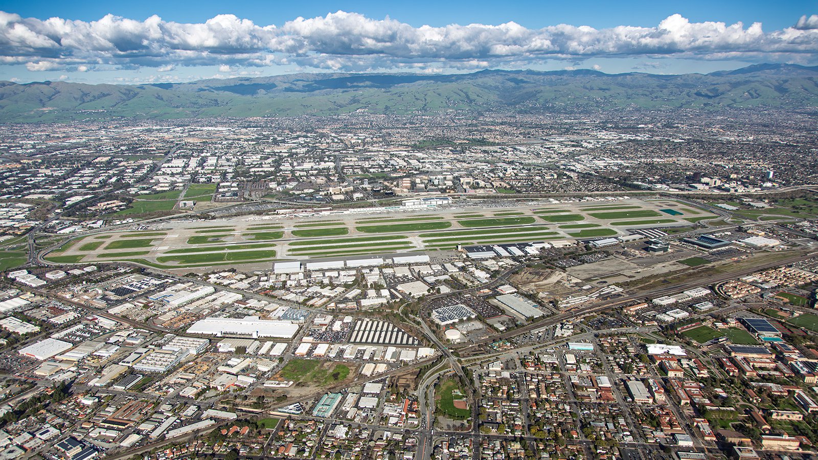
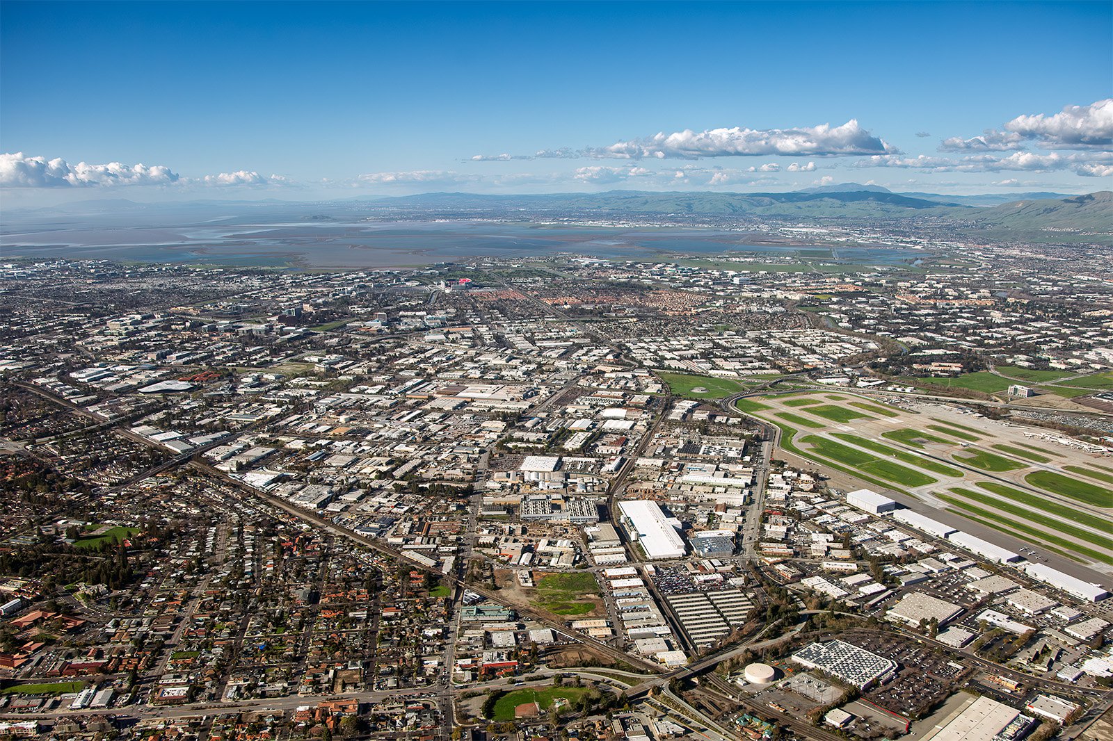
San Jose International Airport (SJC), the gateway to Silicon Valley, is a strategic fixture in the heart of San Jose’s bustling commercial district.
The Benefits of Aerial Photography in San Jose
San Jose, the heart of Silicon Valley, is filled with striking landscapes and iconic landmarks. From the bustling downtown area to the serene Almaden Valley, the visuals that can be captured through aerial photography are limitless. Whether you want to market your property or document a construction project, aerial photography is the optimal solution.
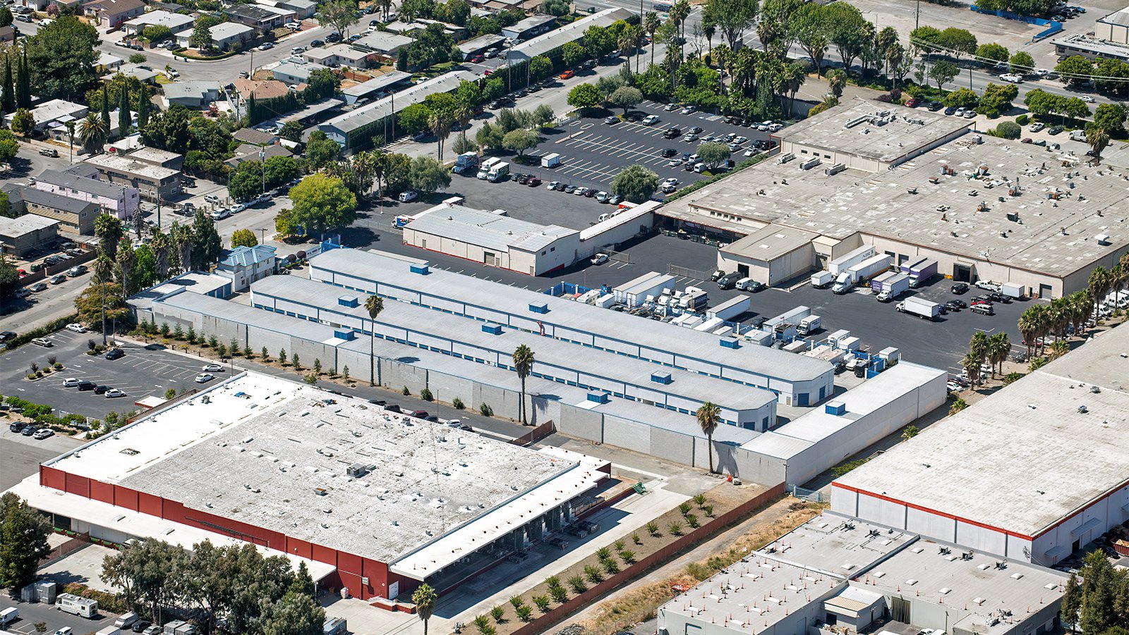
San Jose’s commercial infrastructure powers the region's logistics and economy, with large warehouses and storage facilities positioned throughout the city.
Marketing Real Estate
Real estate agents can leverage aerial photography to market residential or commercial properties listed for sale or rent in Santa Clara County. Aerial photographs provide potential buyers and renters a comprehensive view of the property and its surroundings. This is especially beneficial for large properties where ground photographs might not capture the full extent of the location.
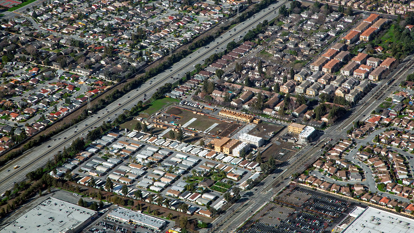
A new multi-family housing development rises alongside a major transit corridor, helping San Jose to meet Silicon Valley’s housing demand.
Monitoring Progress on Construction Projects
Aerial photography is also an effective tool for monitoring progress on large-scale construction projects such as office parks, residential complexes, or tech campuses. Regular aerial photos can help contractors and developers track the progress of their projects without having to constantly be on-site. This not only saves time and money, but also provides a comprehensive overview of the project's development over time. These photographs can be used for insurance purposes, potentially saving developers significant time and money in the event of legal disputes.
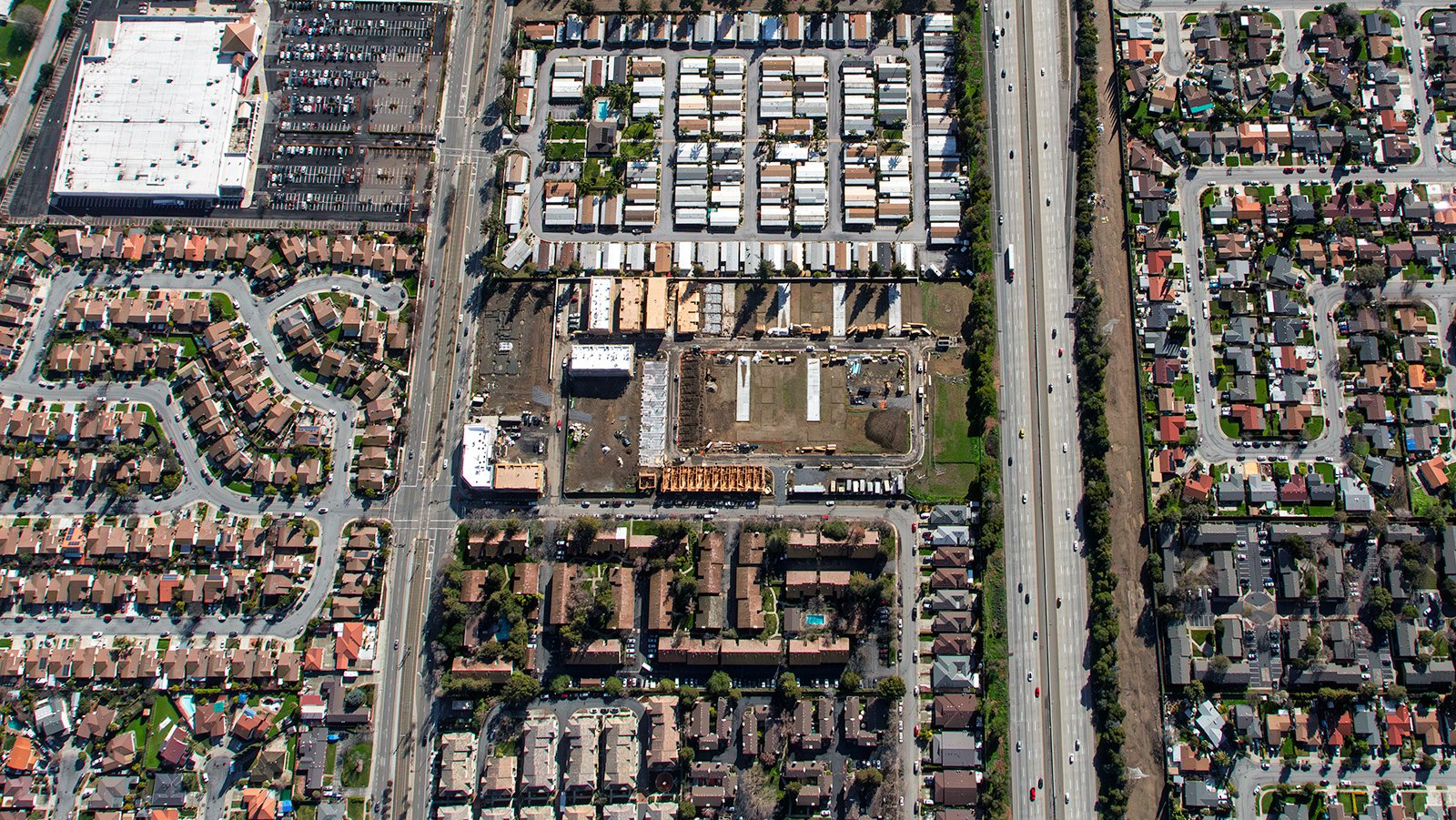
Vertical view of various San Jose residential areas, showing a housing community construction site and existing mobile home park, located alongside a major transportation thoroughfare.
Mapping Entire Neighborhoods
Aerial photography provides practical benefits as well, such as the ability to survey large areas with high-resolution, accurate imagery for GIS and CAD applications. These aerial photo maps can be used for planning purposes or to generate leads for contractors, such as roofing contractors who can easily spot roofs that need repair.
Whether you need to track your construction project's progress or require captivating photographs of San Jose's unique cityscape, aerial photography is your ideal solution and Mark and Steven at West Coast Aerial Photography are your go-to team!
Get in Touch Today
From the electrifying images of Silicon Valley's tech parks to the tranquility of the Santa Cruz Mountains, we aim to encapsulate the unique essence of San Jose in every photograph we take.