
The charming city of San Luis Obispo, located in California's Central Coast, offers a rich tapestry of landscapes. From the rolling hills of Edna Valley to the historic downtown area, aerial photography is the perfect tool to capture the city's unique charm.
What is Aerial Photography?
Aerial photography involves capturing images from an elevated position, most commonly from an aircraft. This special type of photography affords unique perspectives impossible with conventional ground-level photography. Aerial photographers use aircraft to produce exceptional photos of landscapes, cities, landmarks, and more. These images are used in a range of applications, including advertising, marketing campaigns, real estate listings, among others. The sky is truly the limit when it comes to the creative potential possible with aerial photography.
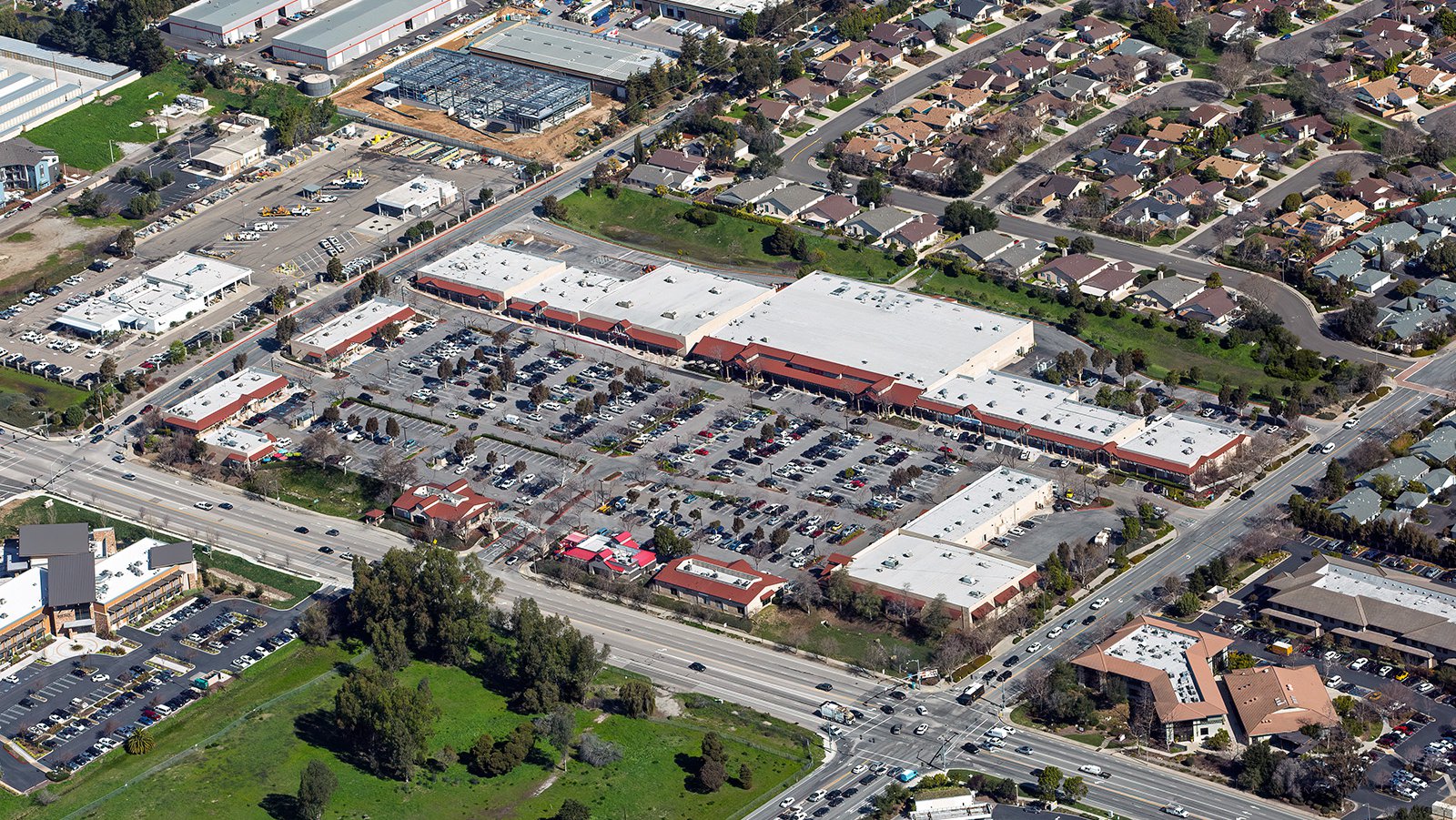
Oblique aerial view of Marigold Center, a large commercial shopping center located in the south side of town.
The Benefits of Aerial Photography in San Luis Obispo
San Luis Obispo, renowned for its scenic wineries and historic architecture, offers a plethora of stunning visuals for aerial photography. Whether you are seeking to highlight your property for prospective buyers or documenting a construction project, aerial photography provides the perfect solution.
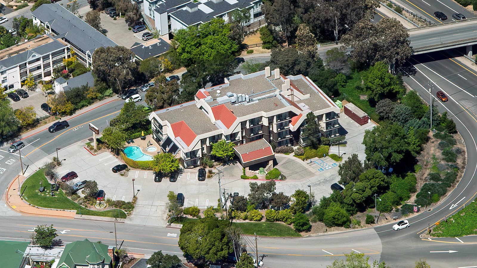
The La Cuesta Inn, situated at the historic northern entrance to SLO, sits across the street from the site of the original Motel Inn, which famously opened in 1925 as the world's very first "motel."
Marketing Real Estate
Real estate agents can leverage aerial photographs to market residential or commercial real estate properties listed for sale or rent in San Luis Obispo County. Aerial images offer potential buyers and renters a comprehensive view of a property and its surroundings. These exclusive shots are particularly beneficial when marketing expansive properties where ground photographs may not capture the full essence of the location.
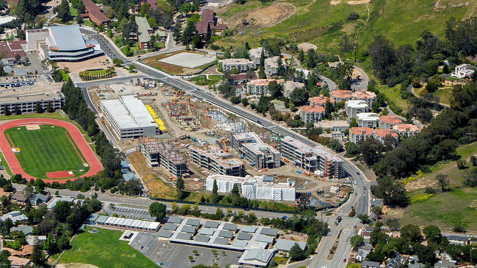
Aerial view of a large construction site on the Cal Poly SLO campus where new student housing and the future Cal Poly Welcome Center begin to take shape.
Monitoring Progress on Construction Projects
Another fantastic application of aerial photography is the tracking of progress on large-scale construction projects. Regular aerial photo shoots allow developers to monitor their work progress without having to frequently physically inspect and go on-site to document the work. This approach saves time and money, while simultaneously providing an accurate overview of the project's development over time. These chronological images can also serve as a reference for insurance purposes, potentially saving developers time and money in litigation scenarios.
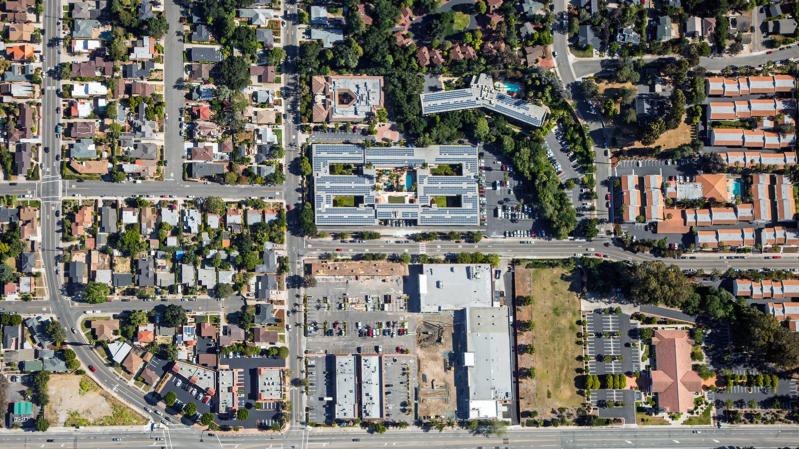
Vertical view of a large, multi-wing residential complex capped with solar panels in San Luis Obispo, Calfiornia.
Mapping Entire Neighborhoods
Beyond its aesthetic appeal, aerial photography also boasts practical advantages. Using aircraft fitted with high-resolution cameras, photographers can survey large areas, producing precise, high-resolution imagery for GIS and CAD purposes. These aerial photo maps can be used for planning purposes or to generate leads for contractors, for example, roofers looking to identify roofs in need of repair.
Whether you're seeking to monitor your construction project's progress, looking for stunning wall photographs capturing the unique allure of the San Luis Obispo cityscape, or need high-quality images for urban planning, aerial photography is the answer!
Get in Touch Today
From captivating photographs of the historic Mission San Luis Obispo de Tolosa to serene sunset shots over the coastline, Mark & Steven at West Coast Aerial Photography aim to encapsulate the unique charm and spirit of San Luis Obispo in every photograph they produce.