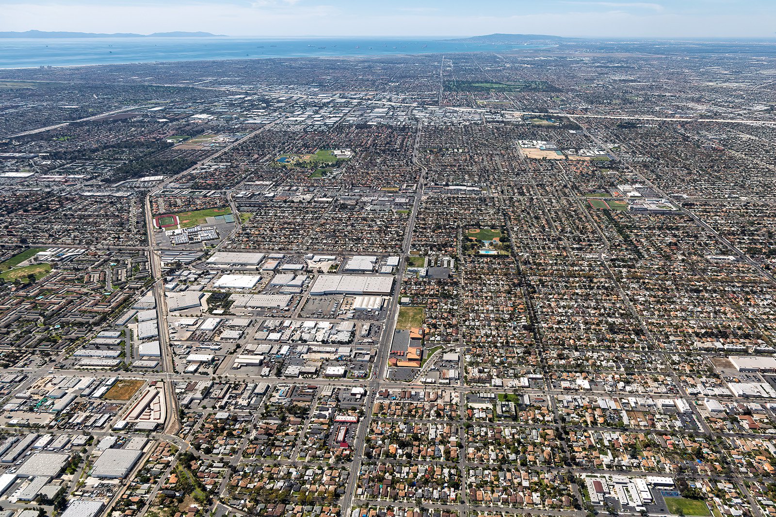
Santa Ana, the vibrant heart of Orange County, has a variety of architectural styles, expansive parks, and bustling urban landscapes. From the Santa Ana River to the historic downtown area, aerial photography unveils the multifaceted charm of this city.
What is Aerial Photography?
Aerial photography involves capturing photos from an elevated position, typically from an airplane. This distinctive form of photography enables the capturing of unique perspectives that are impossible to achieve with standard ground-level photography. Aerial photographers utilize aircraft to take stunning images of landscapes, cities, monuments, and more, for various uses including advertising, marketing campaigns, real estate listings, and beyond. Aerial photography opens a realm of limitless creative prospects.
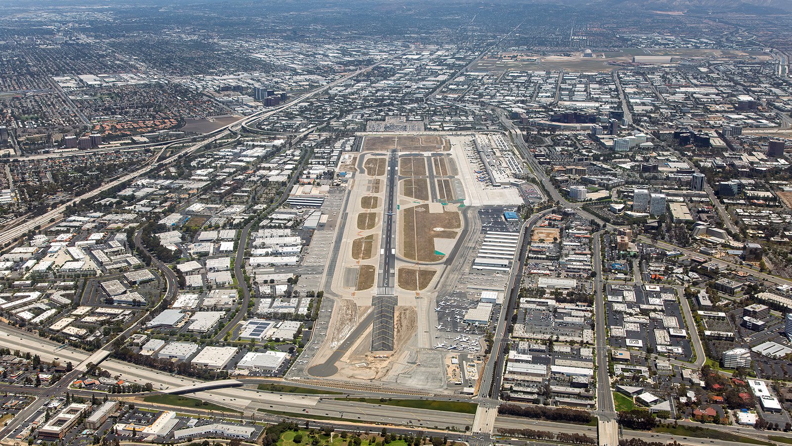
Aerial photo of John Wayne Airport runway and terminal in Santa Ana, surrounded by commercial office parks and flanked by the 73, 405, and 55 freeways.
The Benefits of Aerial Photography in Santa Ana
Santa Ana, with its diverse architecture and vibrant urban landscapes, offers a visually rich terrain for aerial photography. From the historic downtown area to the sprawling Centennial Park, there's a wealth of stunning imagery awaiting capture. Whether you aim to highlight a property for prospective buyers or chart the progress of a construction project, aerial photography is the ideal solution.
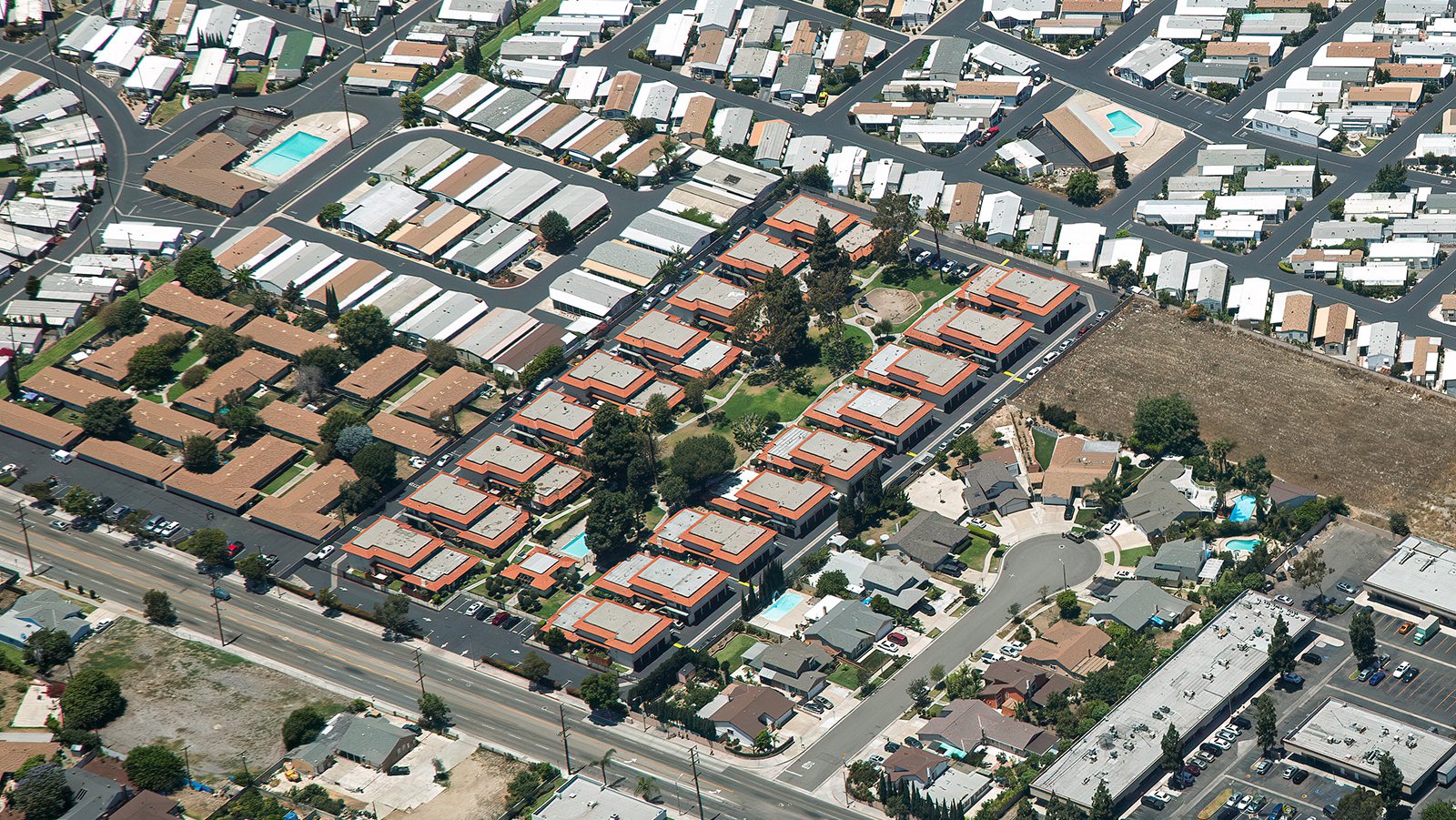
Aerial photography of a Santa Ana residential neighborhood featuring a modern condo complex with a swimming pool, adjacent to a mobile home park and single-family suburban homes.
Marketing Real Estate
Real estate agents can leverage aerial photography to market both residential and commercial properties listed for sale or rent in Santa Ana. Aerial photographs provide potential buyers and renters with an immediate impression of the property and its surroundings. This is particularly beneficial when marketing expansive properties where ground-level photographs fail to capture the full scope.
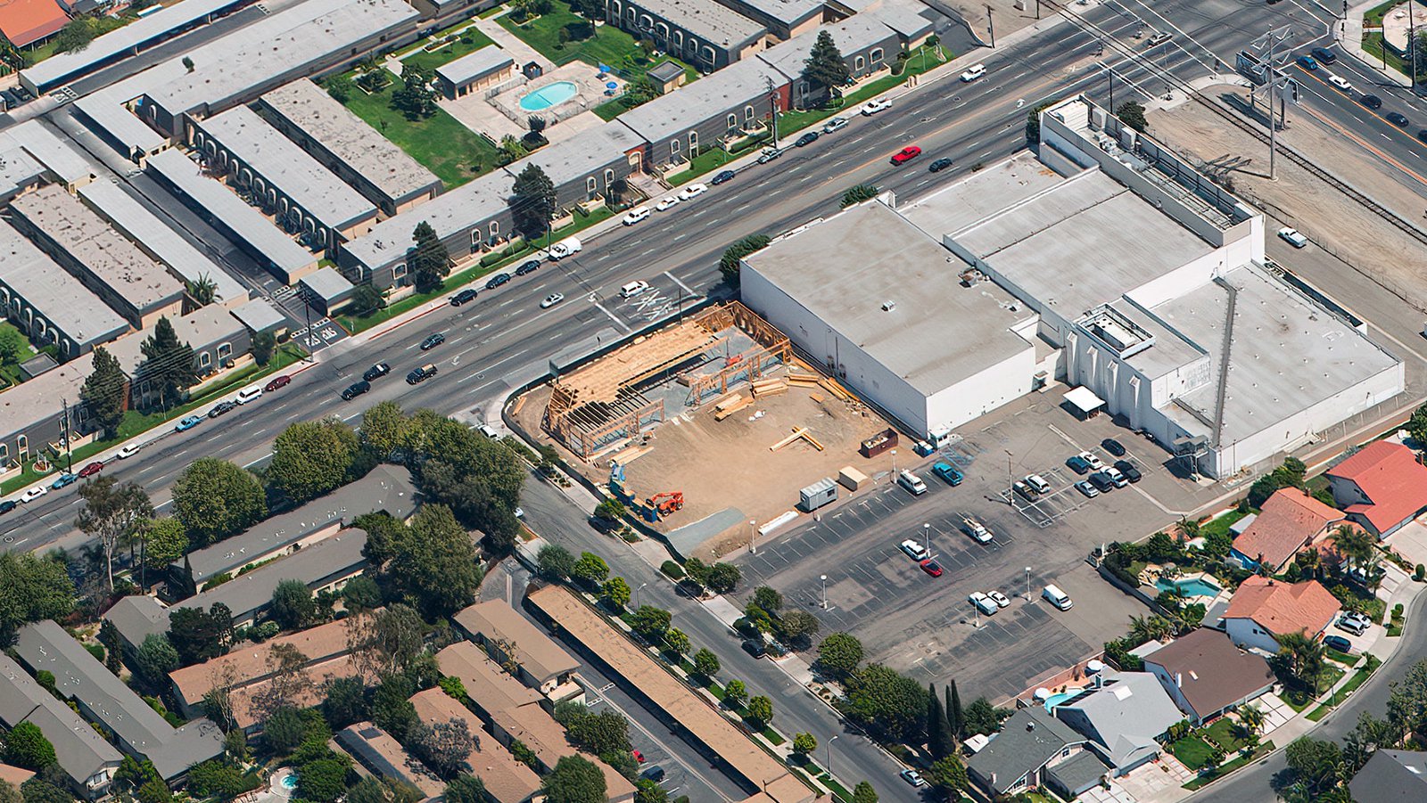
Aerial view of a commercial building construction site with wood framing next to existing commercial buildings and across the street from an apartment complex in Santa Ana, California.
Monitoring Progress on Construction Projects
Aerial photography is also a valuable tool for monitoring the progress of large-scale construction projects such as shopping malls, residential complexes, or industrial buildings. By scheduling regular aerial photo sessions, contractors and developers can keep track of construction progress without time-consuming personal inspections. This not only saves time and money but also provides a comprehensive view of the project's development over time. These photographic records can also be vital for insurance purposes, potentially saving developers time and money in legal disputes.
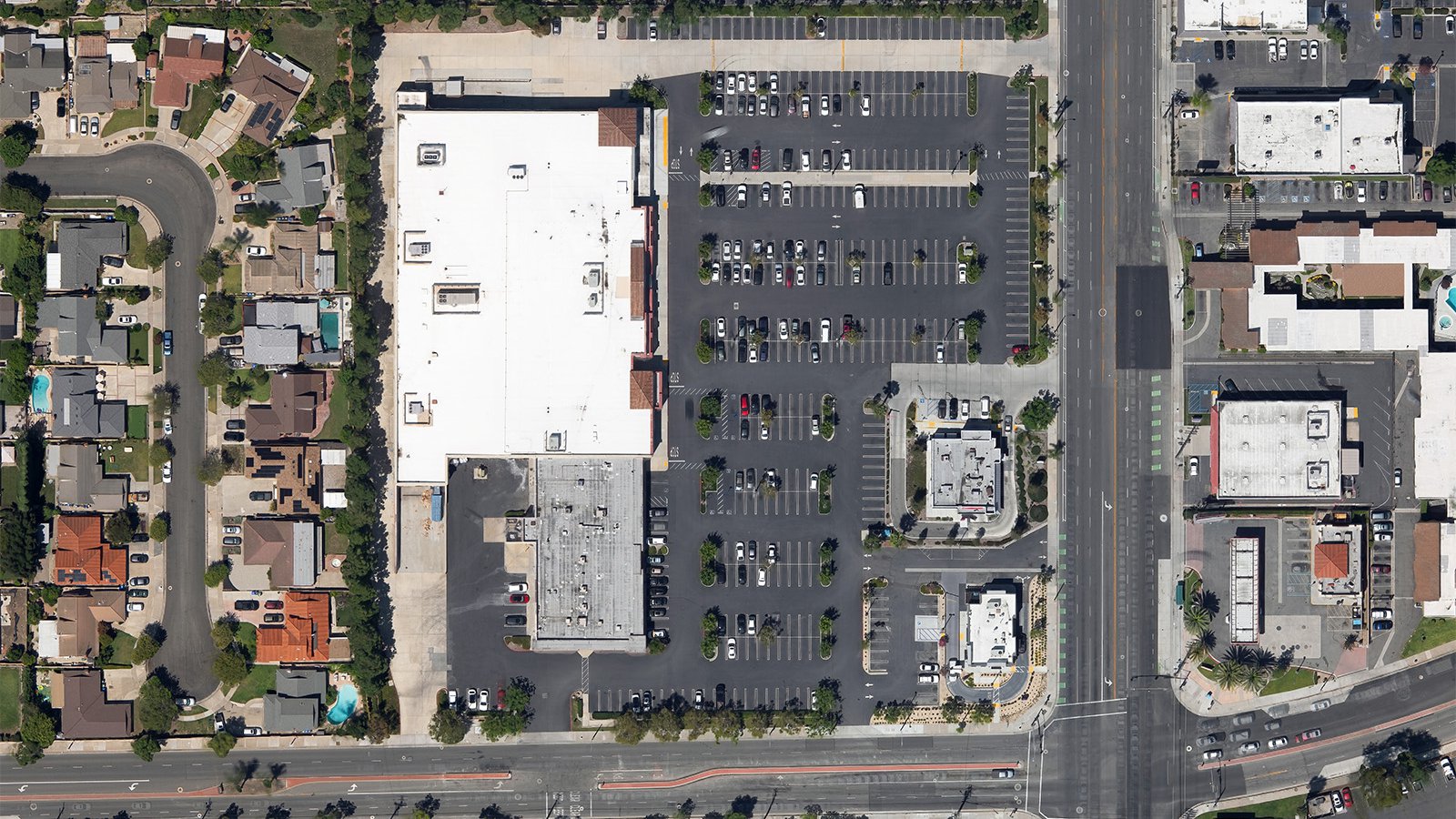
Top-down aerial orthophoto of an ALDI grocery store and parking lot next to a suburban residential neighborhood in Santa Ana, California.
Mapping Entire Neighborhoods
In addition to its aesthetic value, aerial photography also offers practical benefits. Equipped with high-resolution cameras, aerial photographers can survey large areas, producing accurate, high-resolution imagery for GIS and CAD purposes. These aerial photo maps can be used for planning purposes or to generate leads for contractors. For instance, roofing contractors can readily identify roofs in need of repair.
If you're seeking a way to monitor the progress of your construction project or desire stunning photographs that capture the unique beauty of Santa Ana, aerial photography is the perfect solution! Experience an unrivaled view of any landscape or urban environment, ideal for a range of applications. So if you're after top-tier aerial photography services in Santa Ana, your search ends with Mark and Steven at West Coast Aerial Photography, Inc.!
Get in Touch Today
From enchanting aerial views of the Santa Ana River to the bustling downtown scenes at dusk, we aim to encapsulate the distinctive charm and spirit of Santa Ana in each photograph we produce.